


Feb 03, 2026
How Pressure Affects Wind Patterns
Richard Beniston


How Pressure Affects Wind
The Role of Atmospheric Pressure in Shaping Wind Patterns
Wind, a dynamic and ubiquitous feature of Earth's atmosphere, is a crucial factor in weather systems, climate patterns, and human activities. At its core, wind is the movement of air caused by differences in atmospheric pressure. These pressure differences, which can be local or global, set air masses in motion, creating everything from gentle breezes to powerful hurricanes. Understanding how pressure affects wind not only provides insight into meteorological phenomena but also reveals the intricate balance of forces that governs our atmosphere.
For sailors: This knowledge forms part of the meteorology syllabus in RYA theory courses. Understanding the relationship between pressure and wind helps you interpret forecasts and make better decisions on the water.
About the Author
Richard Beniston is an RYA Yachtmaster™ Examiner for Sail and Power, and one of only 22 RYA Yachtmaster™ Instructor Trainers worldwide. With 23 years' experience, Atlantic crossings and three RORC Fastnet campaigns as skipper, he provides student support from Hamble Point Marina for Sailing Course Online and Urban Truant.
Learn more about our instructors
The Basics of Atmospheric Pressure
Atmospheric pressure is the force exerted by the weight of the air above a given point. It decreases with altitude, as there is less air overhead the higher you go. Pressure is typically measured in units such as pascals (Pa), millibars (mb), or inches of mercury (Hg). At sea level, the average atmospheric pressure is approximately 1013 mb.
Pressure differences in the atmosphere arise because of uneven heating of Earth's surface by the sun. Land and water masses absorb and release heat at different rates, creating areas of high and low pressure. High-pressure zones occur where air cools and descends, while low-pressure zones form where air heats up and rises.
For sailors: The shipping forecast's pressure readings tell you something meaningful about expected conditions. A pressure of 1020 mb or above typically indicates settled weather, while readings below 1000 mb suggest unsettled conditions with stronger winds. Noting whether pressure is rising or falling helps you anticipate how conditions will develop.
The Pressure Gradient Force
The most fundamental force driving wind is the pressure gradient force (PGF). This force arises from differences in atmospheric pressure over a certain distance. The air moves from regions of high pressure to regions of low pressure attempting to equalise the pressure differences, much like water flows downhill due to gravity.
The direction and strength of the pressure gradient force are key in determining wind patterns. A steep gradient, where pressure changes rapidly over a short distance, results in strong winds. Conversely, a gentle gradient produces lighter winds. For example, strong pressure gradients around hurricanes and cyclones lead to intense winds, while gentle gradients in high-pressure systems produce calm conditions.
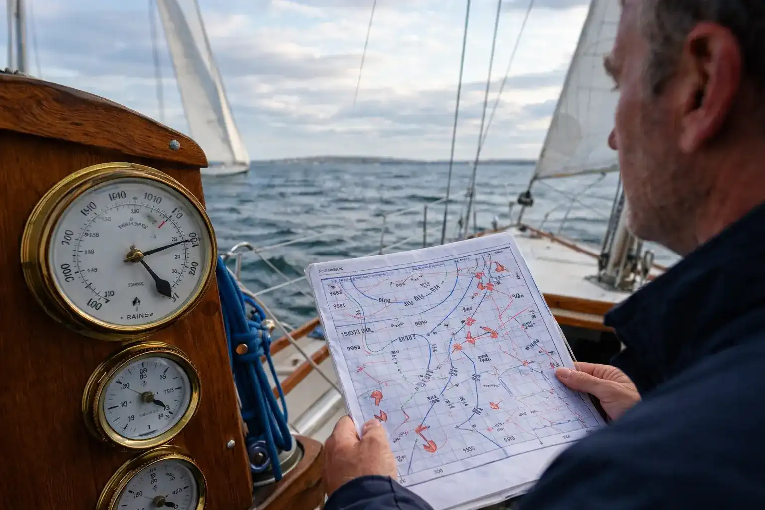
For sailors: On weather charts, look at the spacing between isobars (the lines of equal pressure). Closely spaced isobars indicate a steep pressure gradient and strong winds. Widely spaced isobars mean lighter conditions. This is one of the first skills you'll develop when interpreting synoptic charts during your RYA theory training.
The Coriolis Effect
While the pressure gradient force initiates wind, its path is influenced by Earth's rotation through a phenomenon known as the Coriolis effect. This effect causes moving air to deflect to the right in the Northern Hemisphere and to the left in the Southern Hemisphere. Instead of moving directly from high to low pressure, winds follow a curved trajectory, creating the characteristic rotation patterns of cyclones and anticyclones.
The Coriolis effect increases with the speed of the wind and the latitude of the location. Near the equator, where the Coriolis effect is minimal, winds tend to flow more directly. In contrast, at higher latitudes, the effect is stronger, resulting in more pronounced deflections.
For sailors: In the Northern Hemisphere, if you stand with your back to the wind, low pressure will be on your left. This rule of thumb, known as Buys Ballot's Law, helps you orientate yourself relative to weather systems when you can't see a forecast.
Geostrophic and Gradient Winds
Over time, the pressure gradient force and the Coriolis effect balance each other out, creating a flow known as geostrophic wind. These winds blow parallel to isobars (lines of constant pressure) rather than directly from high to low pressure. Geostrophic winds are most commonly found in the upper atmosphere, where surface friction is negligible.
In some cases, particularly near Earth's surface, friction with the ground causes winds to deviate from geostrophic flow. These winds, known as gradient winds, are affected by pressure gradients, the Coriolis effect, and frictional forces, resulting in air movement that is slightly angled towards lower pressure.
For sailors: The surface wind you experience typically crosses the isobars at an angle of about 10-15 degrees over water (and up to 30 degrees over land). Wind also tends to be lighter and more variable close to the surface than the gradient wind shown on weather charts. This is worth remembering when comparing forecast winds to what you actually experience.
High-Pressure and Low-Pressure Systems
The interaction between pressure and wind is evident in the behaviour of high-pressure and low-pressure systems. High-pressure systems, or anticyclones, are characterised by descending air that diverges at the surface, leading to outward and clockwise wind patterns in the Northern Hemisphere. These systems are often associated with clear skies and stable weather.
Low-pressure systems, or cyclones, involve rising air that converges at the surface, creating inward and counterclockwise wind patterns in the Northern Hemisphere. Low-pressure systems are typically associated with cloudy skies, precipitation, and stormy weather.
For sailors: In summer, high-pressure systems over the UK can bring extended periods of settled weather ideal for cruising, though winds may be light near the centre. The Atlantic depressions that regularly cross the UK bring our changeable weather. Understanding their structure, including the warm and cold fronts that accompany them, helps you anticipate wind shifts and weather changes during a passage.
Local and Global Wind Patterns
Pressure-driven winds operate on both local and global scales. Local winds, such as sea breezes and mountain-valley breezes, result from small, localised pressure differences. For example, during the day, land heats up faster than water, creating a low-pressure zone over the land and a high-pressure zone over the water. This difference drives a cooling sea breeze from the water to the land.
On a global scale, pressure differences give rise to major wind belts, such as the trade winds, westerlies, and polar easterlies. These patterns are shaped by the distribution of high and low-pressure zones across the planet, as well as the Coriolis effect and Earth's rotation.
For sailors: Sea breezes are particularly relevant for coastal sailing in the UK during summer months. On a warm afternoon, you can often rely on a sea breeze filling in along the south coast, even when the synoptic charts show light gradient winds. The prevailing westerlies that affect UK waters are part of the global circulation, bringing our predominantly south-westerly winds and the succession of Atlantic weather systems.
Extreme Weather and Pressure
Pressure gradients are also responsible for extreme weather phenomena. Hurricanes, for instance, are fuelled by intense low-pressure systems over warm ocean waters. The steep pressure gradients around the eye of the hurricane generate sustained high-speed winds that can cause widespread destruction.
Similarly, tornadoes form in areas of severe low pressure, where warm, moist air collides with cold, dry air. The resulting pressure gradients create rotating updrafts, producing the powerful winds characteristic of these storms.
For sailors: While tropical storms rarely affect UK waters directly, remnants of Atlantic hurricanes can bring unusually strong winds to our coasts in autumn. Understanding the relationship between pressure and wind helps you interpret gale warnings and make informed decisions about whether to put to sea. The Met Office's shipping forecast provides pressure readings and trends that experienced sailors use alongside wind forecasts.
Applying This Knowledge: Passage Planning
Understanding how pressure affects wind transforms weather forecasts from abstract information into practical planning tools.
When preparing a passage, consider:
- Current pressure and trend – Is pressure rising, falling, or steady? A rapidly falling (or rising) barometer often precedes deteriorating conditions.
- Isobar spacing – Closely packed isobars on the chart mean stronger winds. Give yourself appropriate sea room.
- Position of pressure systems – Where are the highs and lows relative to your route? How will this affect wind direction during your passage?
- Frontal passages – When fronts cross your track, expect wind shifts and changes in conditions.
These skills are covered in depth in the RYA Day Skipper and Coastal Skipper/Yachtmaster theory courses, where you'll practise interpreting synoptic charts and applying meteorological knowledge to passage planning scenarios.
Human Impacts and Climate Change
Human activities, particularly those related to climate change, are altering pressure patterns and, consequently, wind behaviour. Rising global temperatures are shifting pressure zones and wind belts, leading to changes in weather patterns, such as prolonged droughts, stronger storms, and altered monsoon cycles.
Additionally, urbanisation and deforestation can affect local pressure systems, creating urban heat islands and disrupting natural wind flows. Understanding these changes is critical for mitigating their impact on ecosystems, agriculture, and human settlements.
For sailors: This means historical assumptions about 'typical' conditions may become less reliable over time. Staying informed through quality forecasting sources and understanding the underlying meteorology becomes increasingly valuable.
Conclusion
Pressure is the driving force behind wind, shaping its direction, speed, and behaviour on both local and global scales. From the gentle rustling of leaves to the fury of hurricanes, the interplay between pressure gradients, the Coriolis effect, and friction creates the diverse wind patterns we experience on Earth. As human activities continue to influence atmospheric pressure and climate, understanding these dynamics becomes increasingly important for predicting weather, managing resources, and adapting to a changing world. Wind, in its essence, is a testament to the delicate balance of forces that govern our planet's atmosphere.
For sailors: Whether you're working towards your Day Skipper certificate or building experience for Yachtmaster, meteorology is knowledge that directly applies every time you go sailing.


